What will the upcoming 2026/7 Winter Weather Outlook mean for Alaska overall?
How will it impact South-central Alaska and the greater Whittier area?
One of the most important factors in compiling longer range weather outlooks involves the interaction between air and sea. El Niño and La Niña represent higher/lower than normal temperature conditions in the central and eastern Pacific Ocean. The existence of and strength of these ocean conditions have been identified as key ingredients in the creation of Winter Weather Outlooks, especially in the colder months.
As many have read or heard, scientists confirm a very strong, ‘Super’ El Niño forming in the central and eastern Pacific. Moreover, climate scientists and oceanographers say that this pattern may peak in fall and winter 2026/7 and could be the strongest since 1950.
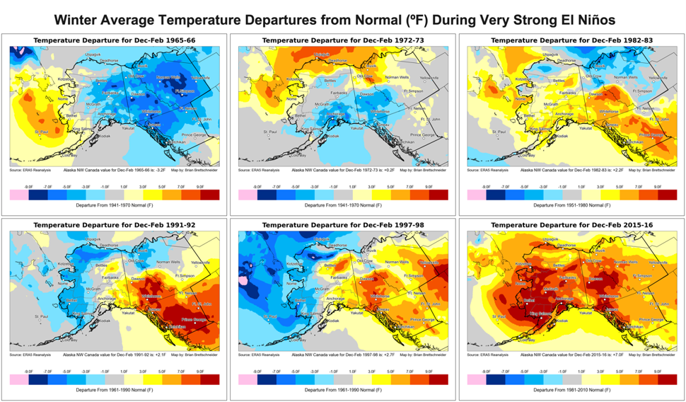
Included in this page are predictions from the NOAA’s Climate Prediction Center (CPC). Additionally, we have included visuals of the top six El Niño years on record and their impacts on Alaska. These are set up from the oldest to the newest.
Interestingly, the December/January 1991/-92 departure map reflects the weakest El Niño event of the six precipitation and temperature maps shown. If this is repositioned to the top left in the display, the a progression from left/top to right/bottom would actually show effects from the weakest of the 6 to the strongest.
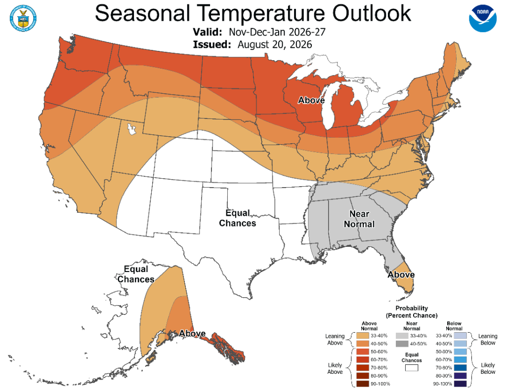
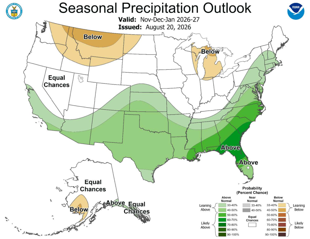
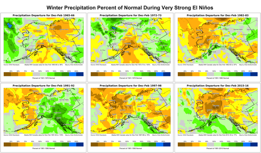
Much of South-central Alaska is likely to see a warmer winter and near-normal precipitation. Portions of Prince William Sound and the eastern North Gulf Coast may see above-normal precipitation.
Additionally, there will likely be more than normal easterly and southeasterly wind events in much of South-central Alaska. Through mountain passes along portions of the Alaska Range, the Anchorage Hillside and Turnagain Arm, higher elevations of the Chugach Range and area adjacent to the southeast corner of Prince William Sound, the pattern could support stronger winds. With milder temperatures, near sea level precipitation may be mostly rain. However, snowfall could increase at higher mountain elevations.
Additionally, we thank Rick Thoman, a climate and weather expert associated with UAF, for providing graphics. We also thank Dr. Brian Brettschneider, a climate scientist, and NOAA CPC, for providing some of the supporting information.